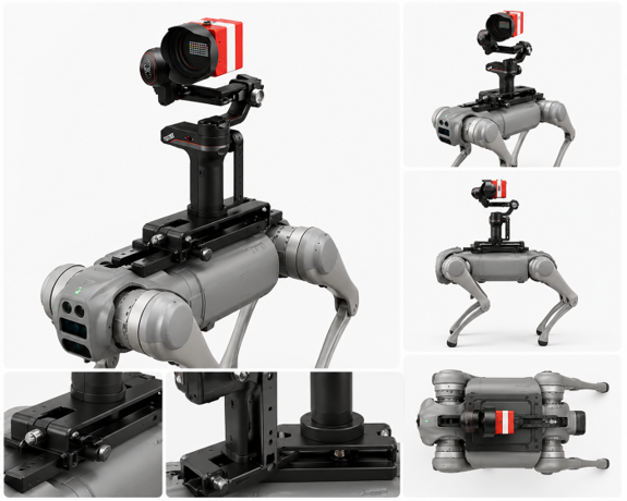
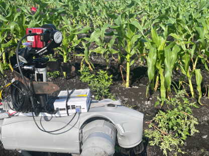
Semi Autonomous Legged Robot With Multisensor Integration for Agricultural Applications

This project develops a semi-autonomous legged robotic platform for proximal canopy and soil sensing in citrus groves. Growers and extension agents need timely tree inventories, nutrient status, and under-canopy soil information, yet dense canopies and soil-compaction concerns limit what conventional platforms can deliver at ground level. The quadruped navigates beneath tree rows and returns maps, statistics, and clear agronomic outputs the same day, without cloud dependency, closing the gap between field sensing and decision-making.


Technical approach

The platform integrates complementary sensors into a single ground-level pass: RGB-D sensing for real-time citrus tree inventory with live field dashboards; hyperspectral canopy imaging for nutrient concentration estimation; proximal NIR soil spectroscopy for under-canopy soil reflectance signatures; and RTK-GNSS with onboard edge computing to georeferenced observations and deliver same-day data products without cloud connectivity. Results are validated against field surveys and ground-truth observations to ensure reliability for operational use.

Expected outcomes

  • real-time citrus tree inventory system validated at over 90% counting accuracy, with live results accessible from any device on the field network. No cloud or post-processing required.

  • Georeferenced canopy nutrient maps (N, P, K, chlorophyll) derived from onboard hyperspectral inference, replacing multi-day laboratory turnaround with same-day GeoJSON outputs for prescription fertilization.

  • Proximal soil spectral signatures at systematic within-row and midrow positions, supporting organic carbon and pH estimation across the soil profile.

  • validated multi-sensor robotic stack that completes canopy, soil, and tree count data collection in a single autonomous pass.
  • Evaluation metrics matching the proposal targets: tree detection mean IoU ≥ 0.9, nutrient estimation R² ≥ 0.8, and soil property prediction R² ≥ 0.7, all delivered within the same field session.

Impact

By lowering technical barriers and accelerating in-field sensing, this project enables faster, more targeted agronomic decisions and more resilient agricultural management at scale. This project delivers same-day tree inventories, canopy nutrient status, and soil health information to growers and extension partners without complex GIS workflows or delayed laboratory turnaround.

Results are shared through peer-reviewed publications, agricultural engineering conference presentations, and extension materials developed with UF/IFAS. Field updates and dataset releases are posted via the Soil Science AI Lab at @SoilAILab on LinkedIn and X.